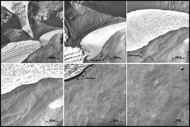
A sequence of images at a nesting scale of 2:1 showing
changes in landforms as a function of scale. Images are at
scales of 5, 2.5, 1.2, 0.6, 0.3, and 0.16 meters per
pixel, equivalent to images that will be acquired by
MARDI at about 150, 105, 72, 47, 30, and 21 seconds
prior to the MSL landing. These are images of a site
in Antarctica. Unlike these pictures, the MSL MARDI
images will be in color and will compose a high
definition video sequence.
|

