


movie (420 kbytes) - Photographed 1/15/94 by M. Malin
Sorted polygon in glacial debris covering floor of Bull Pass in Southern Victoria Land, Antarctica. Located at 77 deg 26.7 min S 161 deg 40.2 min E, at an altitude of 730 m (2460 ft). Both coarse and fine-grained materials can be found in polygonal depressions, and both raised and depressed centers can occur. These polygons have coarse, raised centers, coarse marginal trenches, and coarse-depleted, gently sloping shoulders. Sorted polygons are among a number of enigmatic landforms developed in periglacial environments. A leading explanation for these types of sorted polygons is that the upper regolith in periglacial environments convects, or experiences diapirism, driven either by temperature or density gradients.
movie (230 kbytes) - Photographed 1/8/94 by M. Malin
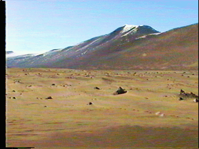
View of Upper Wright Glacier and AirDevronSix Ice Falls, Wright Valley, Southern Victoria Land, Antarctica. The glacier is located at roughly 77.5 deg S, 160.6 deg E, at an altitude of about 1000 m (3280 ft). This view shows how the present upper glacier is "underfit" (that is, does not fill its valley), and is vestigial to the original glaciers that carved the Wright Valley. At the beginning of the sequence, a portion of the Labyrinth is visible. This set of hills and troughs are carved into a sill of the Ferrar dolerite. Several alternative explanations for these troughs have been offered, including formation by salt weathering and subsequent wind removal of sand-sized particles, proglacial drainage, and sub-glacial drainage. The absence of evidence for large scale crystal wedging in the dolerite, and the absence of a continuous path for water to flow, suggests that the sub-glacial explanation (probably involving water) is correct.
movie (165 kbytes) - Photographed 1/20/94 by M. Malin
This view shows the abrasion and weathering test site adjacent to the Allan Hills "blue ice field", near 76 deg 42 min S, 159 deg 24.5 min E, at an altitude of 2000 m (6560 ft). At this site, the experimental objective is to determine if wind-blown ice/snow grains, which are very hard at the low temperatures found on the polar plateau, is capable of abrading rock. Preliminary results suggest that they are: mass loss from abrasion is perhaps an order of magnitude less than in most areas within the ice-free valleys, where sand is abundant, but it is measurable.
movie (139 kbytes) - Photographed 1/20/94 by M. Malin
Killer whales are abundant in the southern ocean, and visit McMurdo Sound after the sea ice disrupts in mid-to-late summer. McMurdo Station is on Ross Island, a volcanic island off the coast of, but linked by the permanent ice field of the McMurdo Ice Shelf, to mainland Antarctica. On one of our flights between the station and the ice-free valleys, we stopped along the ice edge to watch the whales and penguins. The ice was only a foot or two thick, but was sufficient to support the helicopter and people walking to the edge of the ice. The whales appeared to be attracted to the location by the noise of the helicopter. A few minutes after we shut down the engines, they left.
movie (335 kbytes) - Photographed 1/20/94 by M. Malin
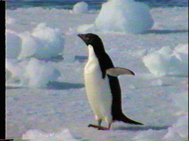
Penguins are even more abundant than Killer whales in the McMurdo Sound region. There are major rookeries at Cape Royds, Cape Barne, and Cape Bird on the western shore of Ross Island. These are Adelie penguins: they stood about 40-45 cm tall (16-18 inches). When Adelie's see humans, they almost always approach very rapidly, calling in a loud, inquisitive (i.e., the pitch of their call rising at the end) voice "Huh? Huh?" Once they realize that these are humans who don't seem to understand what they're saying, their call begins to sound frustrated, and ultimately, irritated (i.e., the pitch of the sound is flat or lowering): "Huh!!! Huh!!!"
movie (200 kbytes) - Photographed 1/20/94 by M. Malin
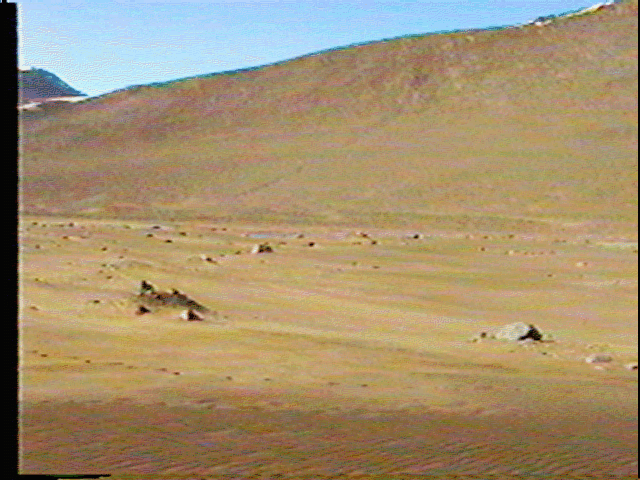
Large gravel ripples in the Allan Hills, Southern Victoria Land, Antarctica, near 76 deg 30 min S, 159 deg E. Viewed looking down from a height of several hundred feet, these large ripples have wavelengths in excess of 5 to 10 m and amplitudes of several tens of cm. They sometimes mimic bedrock undulations; other times they form on essentially flat topography. Particle sizes range up to cobbles, and down to silt, with the majority of the material in the coarse pebble (few cm) range. The best developed ripples will often show coarse bedding or laminations, with imbricated fragments. The matrix is mostly clast supported, and on the whole the material appears ungraded. Several alternative explanations for these ripples have been offered, although none seems to explain all of their attributes. Originally thought to be the result of sub-glacial fluvial processes, they have been variously described as eolian, fluvial, glacial, glaciofluvial, and periglacial. Arguments against eolian and fluvial origins center around the high velocities needed to move such coarse materials by wind (sustained speeds would have had to exceed 240 kph [150 mph]) and the relative angularity of the debris. Arguments against glacial and glaciofluvial processes center on the lack of similar features anywhere else on Earth; there is no known glacial or glaciofluvial process that creates such ripples.
movie (177 kbytes) - Photographed 1/19/94 by M. Malin
Sand blowing around glacial debris near the Victoria Valley sand dunes, Southern Victoria Land, Antarctica (77 deg 22.6 min S, 162 deg 10 min E, 380 m or 1250 ft). Sand moves in response to wind gusts in a very non-uniform way. Both in this sequence, and in the other blowing sand sequence, faint brightness fluctuations occur where streamers of sand wiggle across the surface in response to turbulence in the wind flow. To a stationary object, impingement of these "sand snakes" or "sand ghosts" represent intense periods of flux, and are essentially the only time such an object is abraded. However, at any location the amount of time a given cross-sectional area experiences the movement of a ghost is very small. The commonly held view that sand moves in a "saltating curtain" must be modified to include the movement of sand in organized but chaotic form (i.e., in ghosts).
movie (217 kbytes) - Photographed 1/19/94 by M. Malin
Sand blowing on ice-impregnated, frozen sand dunes in Victoria Valley, Southern Victoria Land, Antarctica (77 deg 22.6 min S, 162 deg 10 min E, 380 m or 1250 ft). Sand moves in response to wind gusts in a very non-uniform way. Both in this sequence, and in the other blowing sand sequence, faint brightness fluctuations occur where streamers of sand wiggle across the surface in response to turbulence in the wind flow. Here, dark, moist sand acts as a hard substrate across which trails of sand (sand "ghosts" or "snakes") can be seen streaking.
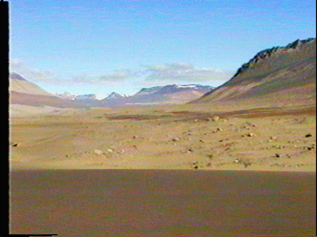
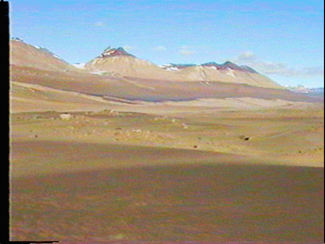
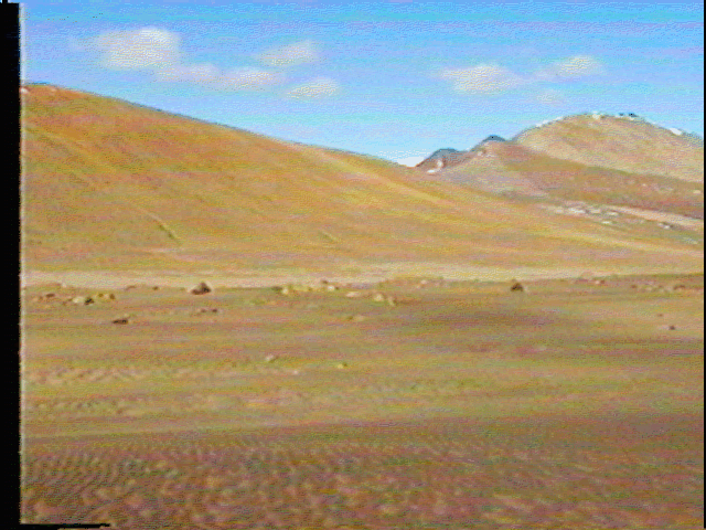
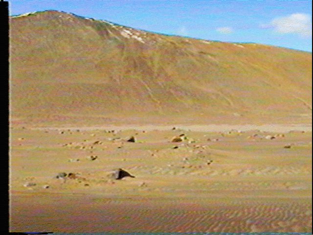
Still Images 1-1.ras through 1-13.ras - Photographed 1/19/94 by M. Malin
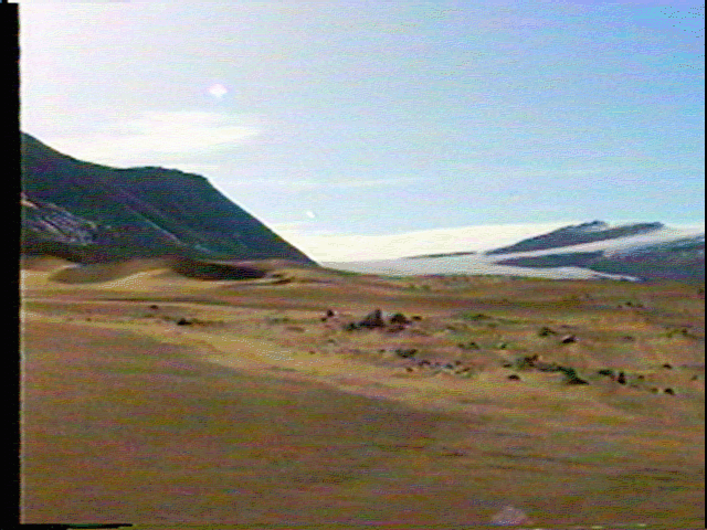
This series of images form a panoramic view of the lower Victoria Valley from the vantage point of the dunes hugging the contact between the valley floor and wall. The site is at 77 deg 22.6 min S, 162 deg 10 min E, at an altitude of 380 m (1250 ft). A brief description of each panel in the mosaic follows:
 - Photographed 1/20/94 by M. Malin
Penguins are abundant in the McMurdo Sound region. There are major rookeries at Cape Royds, Cape Barne, and Cape Bird on the western shore of Ross Island. This is an Adelie penguins: it is about 40-45 cm tall (16-18 inches). When Adelies see humans, they almost always approach very rapidly, calling in a loud, inquisitive voice (i.e., the pitch of their call rising at the end) "Huh? Huh?" Once they realize that these are humans who don't seem to understand what they're saying, their call begins to sound frustrated, and ultimately, irritated (i.e., the pitch of the sound is flat or lowering): "Huh!!! Huh!!!"