 |
|
|
Mike Caplinger, Malin Space Science Systems November 1994
In 1976, the Viking Landers provided us with our only actual views of the Martian surface. For the first time, Mars was a place, not just a point of light in the sky or a series of images taken from hundreds of miles above. But since they were unable to avoid surface hazards on their own, the landers were specifically targeted for some of the flattest areas on Mars (which proved nonetheless to be unexpectedly rocky.) The spectacular vistas of the Martian canyons and volcanoes remained a province of the imagination.
In 1992, the U.S. Geological Survey released its Digital Terrain Model (DTM) of Mars on CD-ROM. (This disk is available from the National Space Science Data Center.) The DTM contains the altitude of each one-kilometer square on Mars, accurate to at worst a few kilometers absolute vertically, and much better in some locations. It was compiled by manually digitizing the contour lines on the 1:2,000,000-scale series of topographic maps that had been previously published by the USGS. For example, here is a portion of Olympus Mons from that map series:
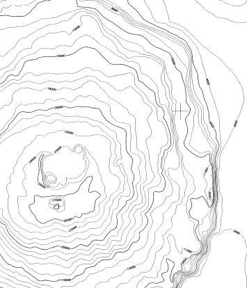
The original contours were at one-kilometer intervals, and had been derived by a combination of Earth-based radar observations, spacecraft radio occultation data, Mariner 9 ultraviolet spectrometer measurements of atmospheric pressure, and photogrammetry using Mariner and Viking images.
Using the digitized contours and interpolation, a complete map of altitudes can be computed. This can be color-coded; here we use shades of gray, where whiter areas are at higher altitudes. (Note, however, that the measurements have not actually been made except at the contour lines; small features between the contour lines will not appear.) The same area of Olympus Mons in DTM form looks like this:
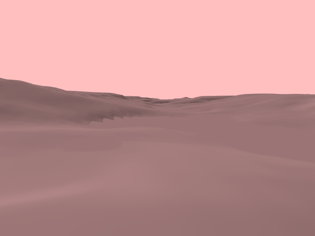
With the USGS DTM, it is possible, using computer graphics, to generate views of the terrain as it would be seen from the surface. The Solar System Visualization Group at the Jet Propulsion Lab did this for their widely-released videotape, Mars: The Movie. However, to emphasize the terrain, they used considerable amounts of "vertical exaggeration"; that is, they rendered the terrain as though it was much steeper than it actually is. The results can be somewhat misleading.
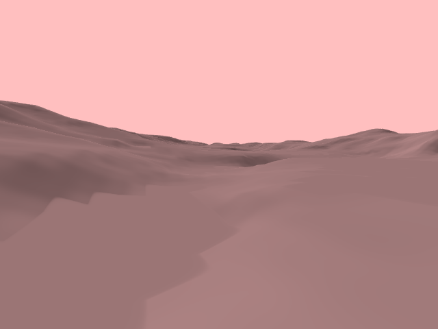
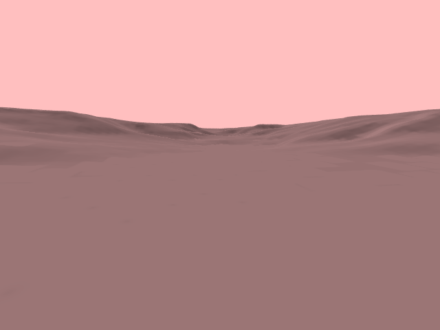
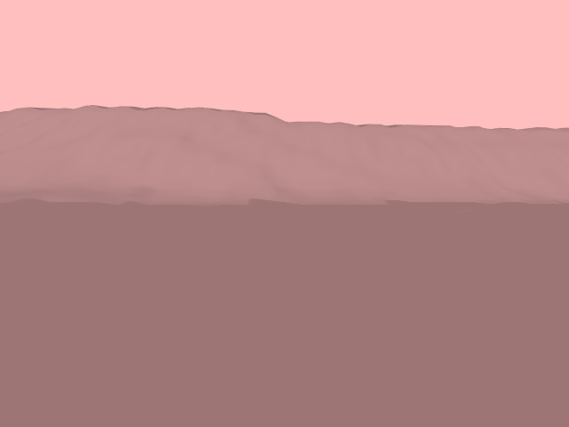
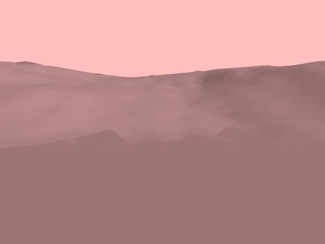
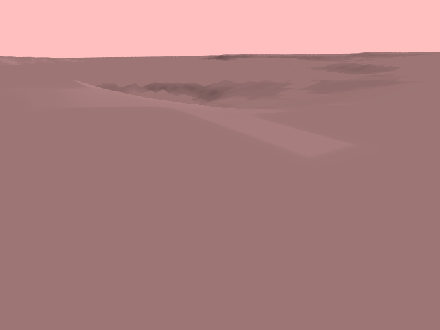
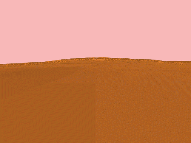
With this in mind, we present a series of views of the Martian terrain as it might actually appear, with no vertical exaggeration. Note that the terrain slopes are actually quite gradual. For example, the Martian shield volcano Ascraeus Mons, while it rises over 20 kilometers above the surrounding plains, does so at such a slight angle that from a distance, it appears to be a shallow hill. (An exception is the remarkable scarp surrounding Olympus Mons, which rises about 7 kilometers almost vertically.)
In most cases, we have simply shaded the terrain, without using texture provided by photographs taken from orbit. This is because the resolution of such photographs is rarely high enough to provide much detail in the foreground anyway. Beginning in 1998, we hope to use the very high-resolution images and altimeter data obtained from instruments on board the Mars Global Surveyor spacecraft to generate views of what the surface might look like at a scale of a few meters. Until then, such images will have to serve as our only views of the most impressive regions of Mars. (The JPL Mars Pathfinder mission, planned to land in the outflow region of Ares Vallis in 1997, will see an area only slightly less flat than the Viking landing sites.)
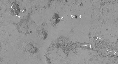
1. Looking west across Tithonium Chasma
2. Looking west across Coprates Chasma
3. Looking east across Hebes Chasma
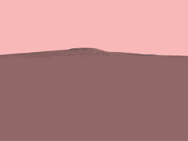
4. Looking east at the shield volcano Tharsis Tholus
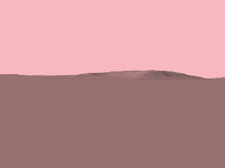
5. A similar view of Tharsis Tholus from the west
6. The 7-kilometer scarp face on the east edge of Olympus Mons, looking west
7. Looking northwest at the Olympus Mons scarp edge
8. Looking northeast into the Olympus Mons caldera from its edge
9. Ascraeus Mons, looking west (textured with Viking data)
Note: Although these images have no vertical exaggeration, they were generated without accounting for the curvature of the planet; hence, in some cases, distant parts of the terrain might actually be "over the horizon" from the viewpoint.
Mike Caplinger (mc@msss.com)