Today, 30 September 2003,
the Mars Global Surveyor (MGS) Mars Orbiter Camera (MOC)
team is pleased to announce the release of 10,232 newly-validated,
archived images acquired between August 2002 and February 2003.
These MOC Extended Mission data were obtained during portions
of the martian northern spring and summer seasons (autumn
and winter in the southern hemisphere), and thus include many
new views of north polar terrain, extremely clear-atmosphere
views of Hellas Planitia, and a variety of martian landforms
between the north pole and southern middle latitudes.
The new data can be viewed by visiting the Malin Space
Science Systems
MOC Gallery.
The
MOC Gallery
now contains more than 134,000 images acquired by the MGS
camera since it began taking pictures in September 1997.
The data now span more than 2 full Mars years since the mapping
phase of the mission began in March 1999.
Every six months, a new suite of MGS MOC data are archived with the
NASA Planetary Data System (PDS).
Archiving occurs after a labor-intensive effort to validate
the data acquired in the previous six-month period.
The three pictures shown here are examples of the high resolution
data acquired during the August 2002 through February 2003 period.
Captions for each image follows:
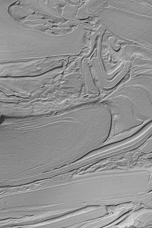
MOC2-499a: Hellas "Taffy Pull":
Some of the strangest-looking surfaces on Mars occur
in northwestern Hellas Planitia. Over the years, the
Mars Global Surveyor (MGS) Mars Orbiter Camera (MOC)
team has informally--quite informally--taken to calling
these surfaces, "taffy-pull terrain." This
image shows an example located near 39.2°S, 305.2°W.
The origin of this pattern is unknown, although it
is thought to be related to the erosion of different layers
of bedrock or substrate of differing physical properties.
That is, a hard layer would be more difficult to erode than a soft,
or poorly-consolidated layer. However, layering and erosion
alone probably do not explain these landforms; perhaps
faulting or mass movement of debris is also involved.
As with all other explorations in our Solar System,
sometimes the pictures we get back from space present
us with more questions, rather than answers.
This image covers an area 3 km (1.9 mi)
across; sunlight illuminates the scene from the upper left.
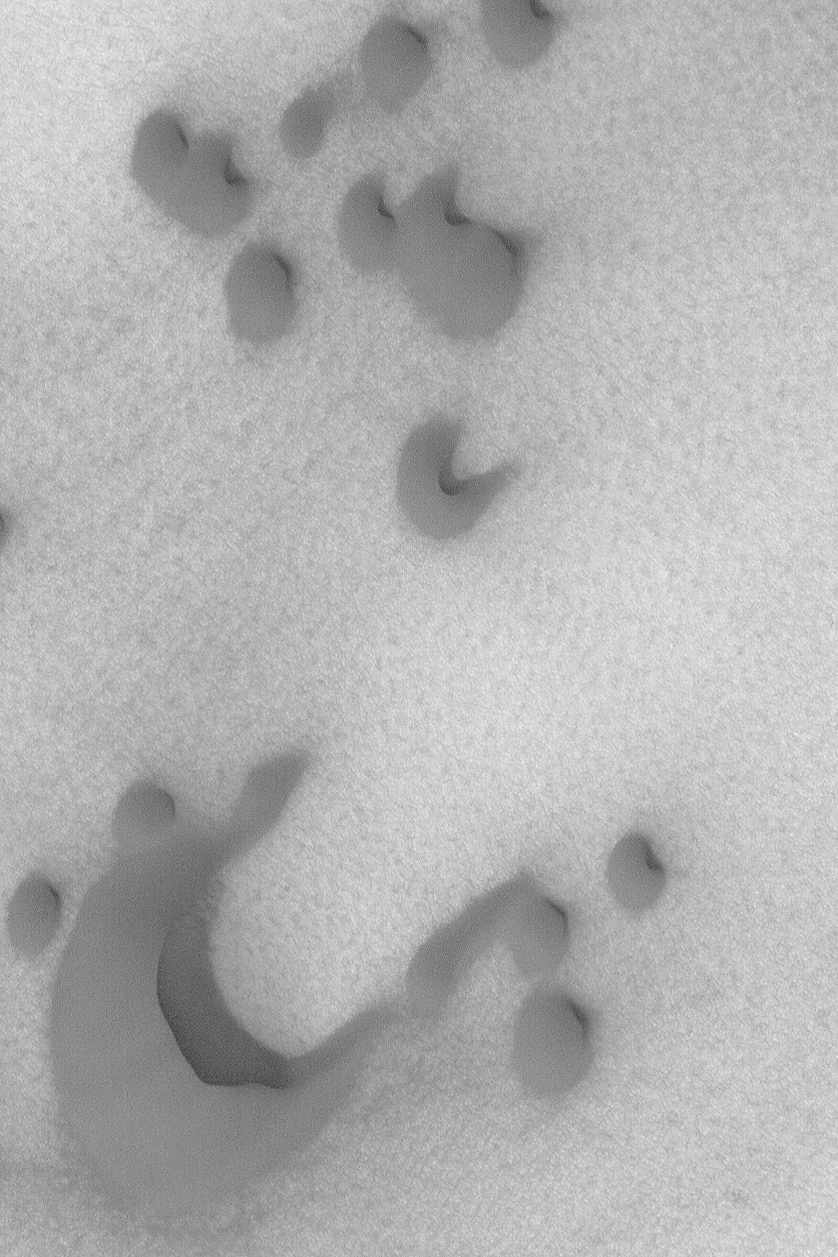
MOC2-499b: North Polar Dunes:
The steepest slope on a sand dune, the slipface,
indicates the general direction that wind has been transporting sediment.
This Mars Global Surveyor (MGS) Mars Orbiter Camera (MOC)
image shows several dark sand dunes in the north polar
region. Sand transport in this case is from the lower
left (southwest) toward the upper right (northeast).
The picture is located
near 76.5°N, 257.4°W, and covers an area 3 km (1.9 mi)
across. Sunlight illuminates the scene from the lower left.
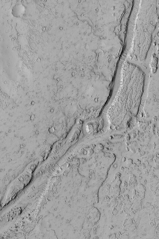
MOC2-499c: Valley near Phlegra Dorsa:
This February 2003 Mars Global Surveyor (MGS) Mars Orbiter Camera (MOC)
picture shows a valley in the Phlegra Dorsa region of Mars
near 26.3°N, 186.2°W. The valley might have formed by flowing
water or lava, but very little is yet known about this valley---where is its
source? where does it end? The valley is intimately associated with
lava flows, and might therefore result from volcanism rather than
water. The fluid responsible for the valley moved from the lower left
(southwest) toward the upper right (northeast).
The picture covers an area 3 km (1.9 mi) wide. The scene is
illuminated by sunlight from the left.
Tips for Media Use
Malin Space Science Systems and the California Institute of Technology
built the MOC using spare hardware from the Mars Observer mission.
MSSS operates the camera from its facilities in San Diego, California.
The Jet Propulsion Laboratory's Mars Surveyor Operations Project
operates the Mars Global Surveyor spacecraft with its industrial
partner, Lockheed Martin Astronautics, from facilities in Pasadena,
California and Denver, Colorado.

 To MSSS Home Page