
Mars Global Surveyor
|
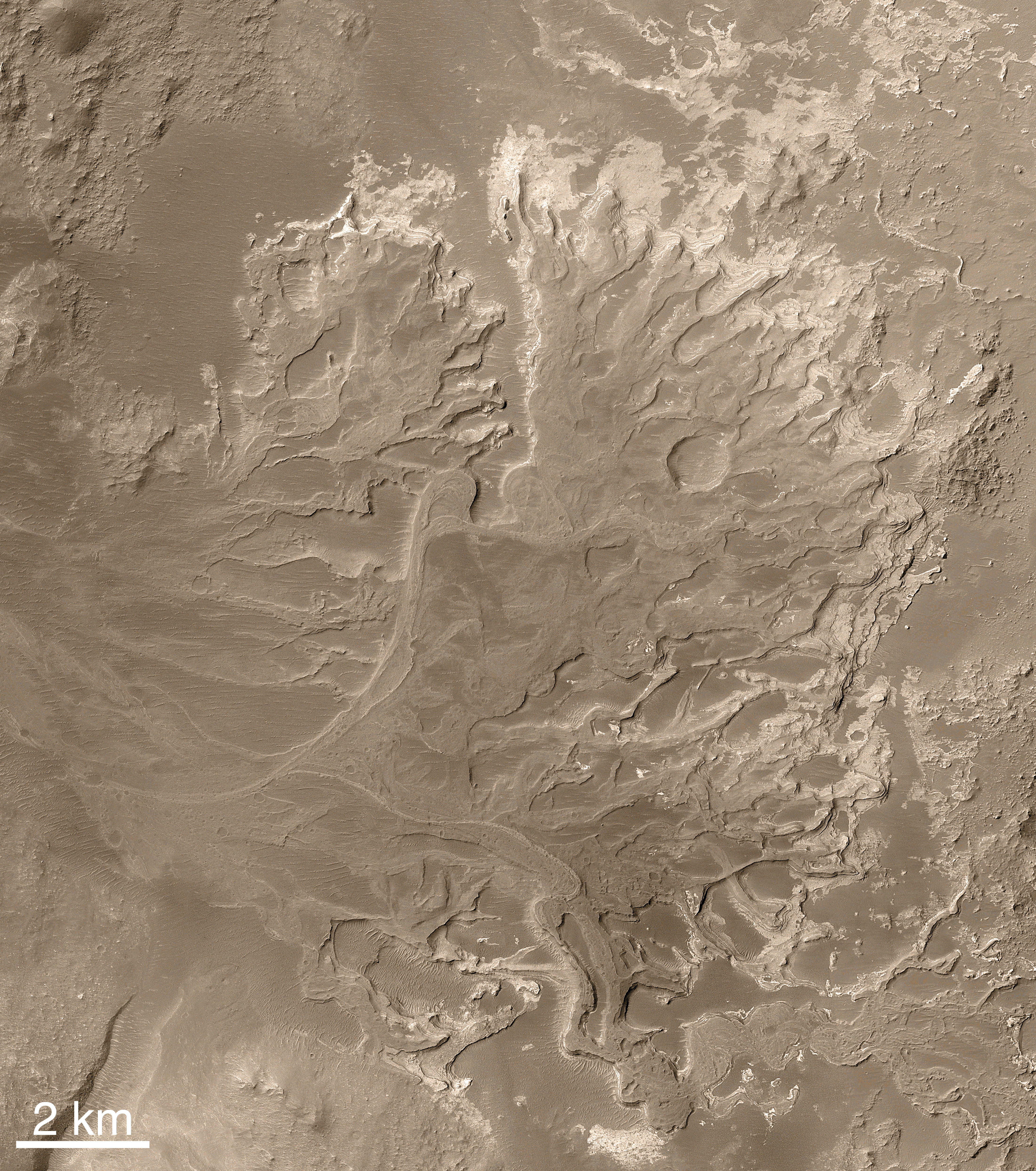
MOC2-1225a: Mosaic of MOC images of Eberswalde delta. 25% size (1.5 MB) -- 50% size (6.1 MB) -- Full size (24.8 MB) NASA/JPL/Malin Space Science Systems |
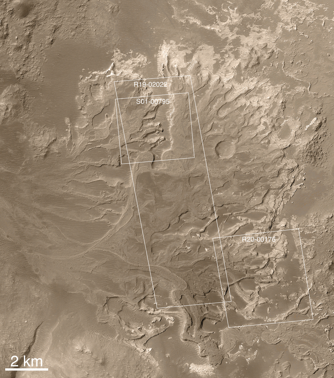
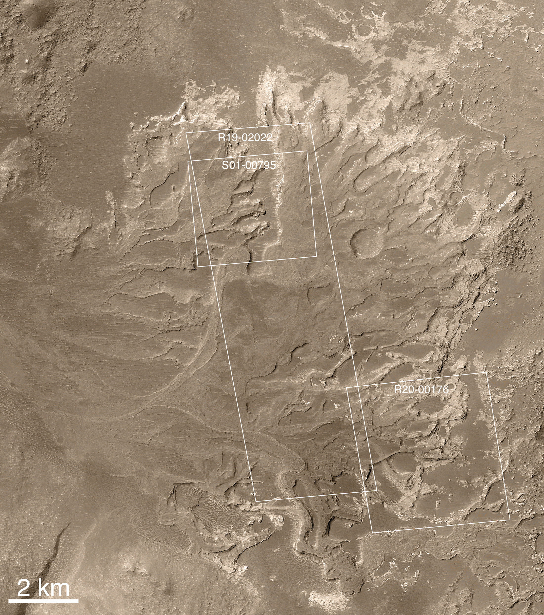
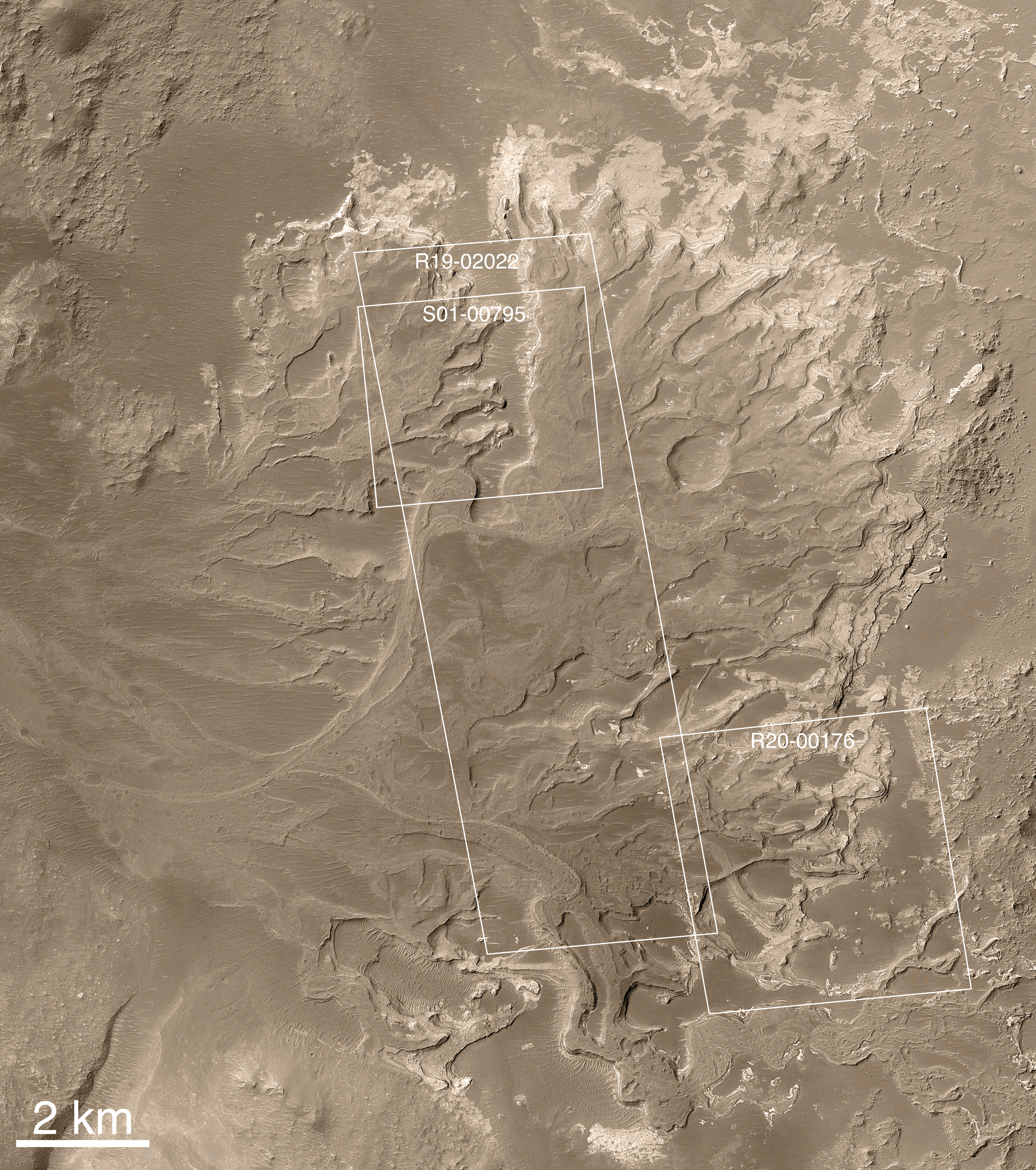
MOC2-1225b: White boxes indicate location high resolution views. 25% size (1.5 MB) -- 50% size (6.1 MB) -- Full size (24.8 MB) NASA/JPL/Malin Space Science Systems |
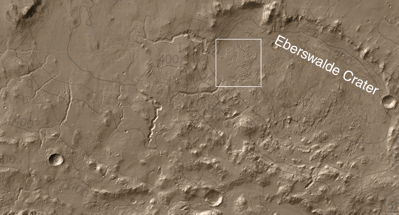
MOC2-1225c: Context in THEMIS IR mosaic of Eberswalde Crater. Full size (1.1 MB) NASA/JPL/Malin Space Science Systems |
MOC2-1225d: Sub-meter-per-pixel cPROTO image S01-00795. 25% size (1.6 MB) -- 50% size (6.2 MB) -- Full size (23 MB) NASA/JPL/Malin Space Science Systems |
MOC2-1225e: Image R19-02022. view of a portion of Eberswalde delta, image R19-02022") 50% size (2.6 MB) -- Full size (10.7 MB) NASA/JPL/Malin Space Science Systems |
MOC2-1225f: Image R20-00176. view of a portion of Eberswalde delta, image R20-00176") 50% size (1.2 MB) -- Full size (4.7 MB) NASA/JPL/Malin Space Science Systems |
|
Scientifically, perhaps the most important result of the Mars Global Surveyor (MGS) Mars Orbiter Camera (MOC) investigation during the MGS Extended Mission has been the discovery and documentation of a fossil delta located in a crater northeast of Holden Crater near 24.0°S, 33.7°W. Since the announcement of the discovery of the delta in November 2003, the International Astronomical Union has provided a provisional name (pending final approval) for the crater in which the landforms occur. The crater has been named Eberswalde, for a town in Germany. The first MOC narrow angle camera images of some of the landforms in the delta were acquired during the MGS Primary Mission in 2000, but these pictures did not show (very well) the unambiguous inverted channel forms that are now so clearly seen in the MOC narrow angle camera mosaics presented here. It wasn't until well into the second Earth year of the MGS Extended Mission that the deltaic features were recognized in MOC images obtained in March and June of 2002. Following the initial observations in 2002, the MOC team began a systematic effort to map out the entire Eberswalde Crater delta. This usually required slewing the MGS spacecraft (ROTO, Roll Only Targeted Observation) such that it pointed the MOC toward the feature, so that an image could be acquired. In this way, the MOC team was able to build up a mosaic of the delta much more quickly than would have been the case if the team had simply relied upon chance crossing of the delta by MGS's usual ground track. This ROTO technique was not employed during the Primary Mission, except in the search for Mars Polar Lander, but became a routine part of the MOC investigation "tool kit" during the Extended Mission. Even with the ROTO technique, it took more than 1 Earth year to build up a complete mosaic of MOC images of the delta. In the mean time, the first data showing the deltaic landforms were archived and released to the public and scientific community, long before the MOC team's analysis and mosaicing effort was complete. Some scientists began their own, independent analyses of the landform at that time. The initial analysis and announcement of the feature was finally published in November 2003. The Eberswalde delta provides the first clear, "smoking gun" evidence that some valleys on Mars experienced on going, persistent flow of a liquid with the physical properties of water over an extended period of time, as do rivers on Earth. In addition, because the delta today is lithified -- that is, hardened to form rock -- it provided the first unambiguous evidence that some martian sedimentary rocks were deposited in a liquid (presumably, water) environment. The presence of meandering channels, a cut-off meander, and crisscrossing channels at different elevations (one above the other), provided the clear geologic evidence for these interpretations. After the sediments were deposited to form the delta, the material was further buried by other materials -- probably sediments -- that are no longer present. The entire package of material, now buried, became cemented and hardened to form rock. Later, erosive processes such as wind stripped away the overlying rock, re-exposing the delta. Now preserved essentially as a fossil, the former floors of channels in the delta became inverted, to form ridges, by erosion. Channels can be inverted by erosion on both Earth and Mars. Usually this happens when the channel floor, or the material filling the channel, is harder to erode than the surrounding material into which the channel was cut. In some cases, the channels on Earth and Mars have been filled by lava to make them more resistant to erosion. In the case of Eberswalde, there are no lava flows; instead, the channel floors may have been rendered resistant to erosion either by being better-cemented than the surrounding material, or composed of coarser-grained sediment (e.g., sand and gravel as opposed to silt), or both. The pictures shown here illustrate our continued exploration of the delta in Eberswalde Crater. The top two pictures present the MOC narrow angle image mosaic that was originally released in November 2003. The second of these shows three white boxes, each of which indicates the location of a new, higher-resolution MOC image obtained in 2004 to permit examination of finer-scale details on the fan. The third picture, also from 2003, shows the location of the fan in Eberswalde Crater. The topographic contours come from MGS Mars Orbiter Laser Altimeter (MOLA) data; the base map comes from infrared images acquired by the Mars Odyssey Thermal Emission Imaging System (THEMIS), and the colors in all three pictures were derived from representative THEMIS visible (VIS) images. The fourth image, covering about 3 by 3 kilometers (1.9 x 1.9 miles), is a MOC Compensated Pitch and ROll Targeted Observation (cPROTO) view of a portion of the delta. At full resolution, this map-projected image is at 50 centimeters (1.6 ft) per pixel. The imaging objective in this case was a looping, inverted, cut-off meander channel, but cPROTO targeting is challenging and the targets are not usually hit on the first or even the second attempt. In this case, the image captured only the north end of the looping feature. The fifth and sixth images show other details on the fan at a spatial scale of 1.5 meters (~5 feet) per pixel, also providing additional details of the geology of the inverted channels in the Eberswalde Crater delta.
Reference Material:
|
Malin Space Science Systems and the California Institute of Technology built the MOC using spare hardware from the Mars Observer mission. MSSS operates the camera from its facilities in San Diego, California. The Jet Propulsion Laboratory's Mars Surveyor Operations Project operates the Mars Global Surveyor spacecraft with its industrial partner, Lockheed Martin Astronautics, from facilities in Pasadena, California and Denver, Colorado.
 To MSSS Home Page