
Mars Global Surveyor
|
(A) MOC2-1619-a
Annotated Image — No Annotation |
(B) MOC2-1619-b
No Annotation |
(C) MOC2-1619-c
Annotated Image — No Annotation |
(D) MOC2-1619-d
No Annotation |
Two martian southern mid-latitude craters have new light-toned deposits that formed in gully settings during the course of the Mars Global Surveyor (MGS) mission. Images from the Mars Orbiter Camera (MOC) documented one case in an unnamed crater in Terra Sirenum, described in an accompanying release, “New Gully Deposit in a Crater in Terra Sirenum”. The second case, in an unnamed crater in the Centauri Montes region, east of the Hellas Basin, is described here.
Gullies were first described by MOC scientists in June 2000, and many examples were presented in our June 2000 captioned web releases and in a paper published in the journal, Science. Additional examples of these middle and high latitude landforms can be seen among the other more than 1600 MGS MOC captioned releases.
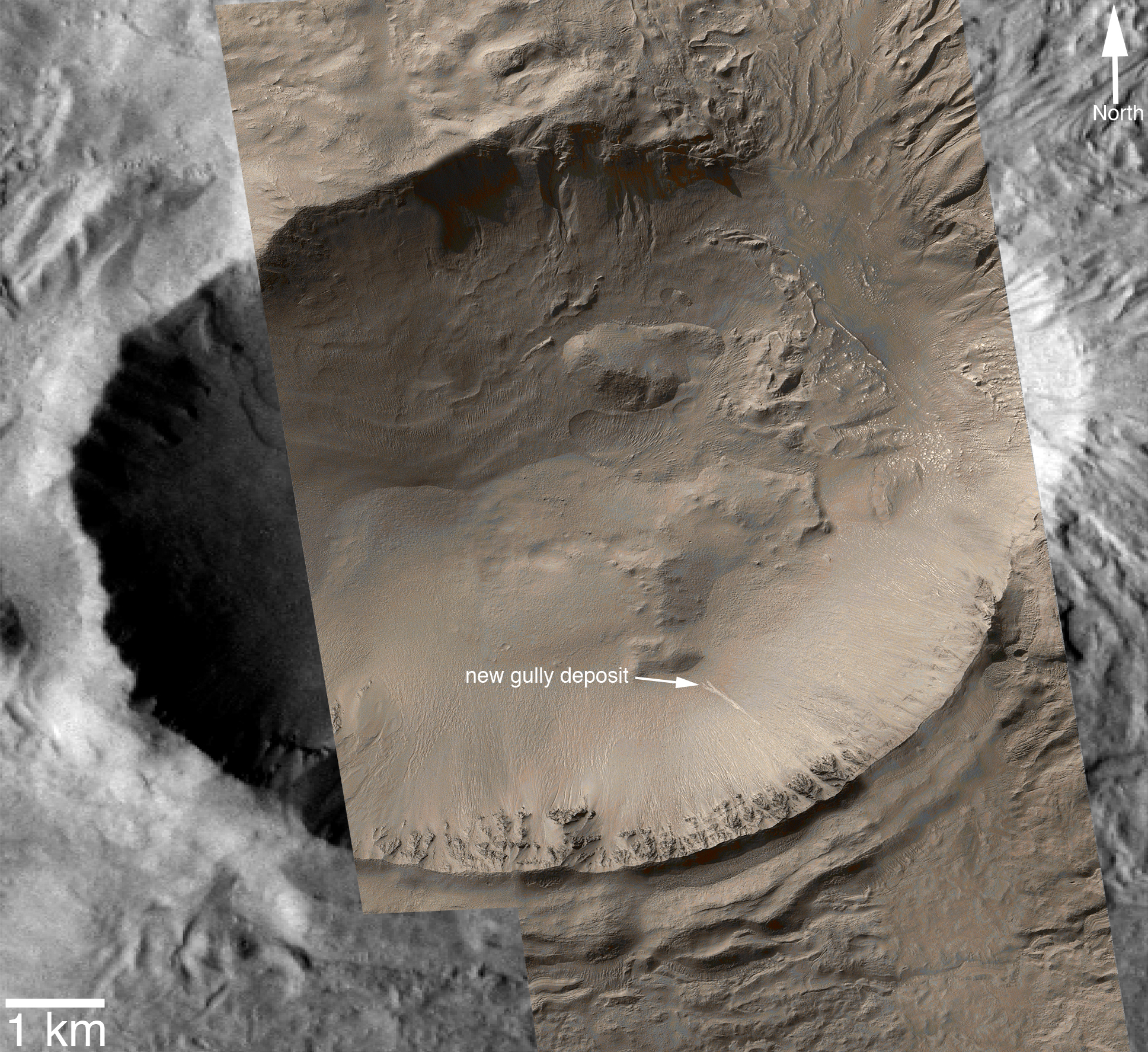
The new gully deposit in an unnamed crater in the Centauri Montes region is located near 38.7°S, 263.3°W. Like the new gully deposit in Terra Sirenum, this one has a light tone relative to its surroundings. It is on an equatorward-facing slope on which occur numerous narrow gully channels. As this slope is always in sunlight during the afternoons when MGS passes overhead, the gullies always appear somewhat “washed out,” just as do craters on a full Moon when viewed from Earth with a telescope.
The new, light-toned flow was first noticed by the MOC science operations team in MOC image S10-00142, acquired on 10 September 2005. Re-examination of other images of this crater showed that the new deposit had actually been present on 21 February 2004, when the distal (down-slope) end of the deposit was captured near the edge of MOC image R14-02285. In February 2004, the deposit had gone unnoticed because only a small portion of it was imaged. This location was first imaged by MOC on 30 August 1999 (image M04-04175). The deposit was not present at that time. Thus, it formed between 30 August 1999 and 21 February 2004.
Roughly 20% brighter than the surface as it appeared before the flow occurred, the new deposit exhibits characteristics consistent with transport and deposition of a fluid that behaved like liquid water and likely transported some fine-grained sediment along with it. The distal end of the flow broke into several branches, or digits, and the material diverted and flowed around low obstacles. As with the example in Terra Sirenum, the flow thickness is too thin to be measured in 1.5 m/pixel MOC images, so a very small volume of liquid and sediment was involved. While the material flowed and easily budded into several branches, it also must have moved slowly such that it did not over-top some of the low obstacles in its path.
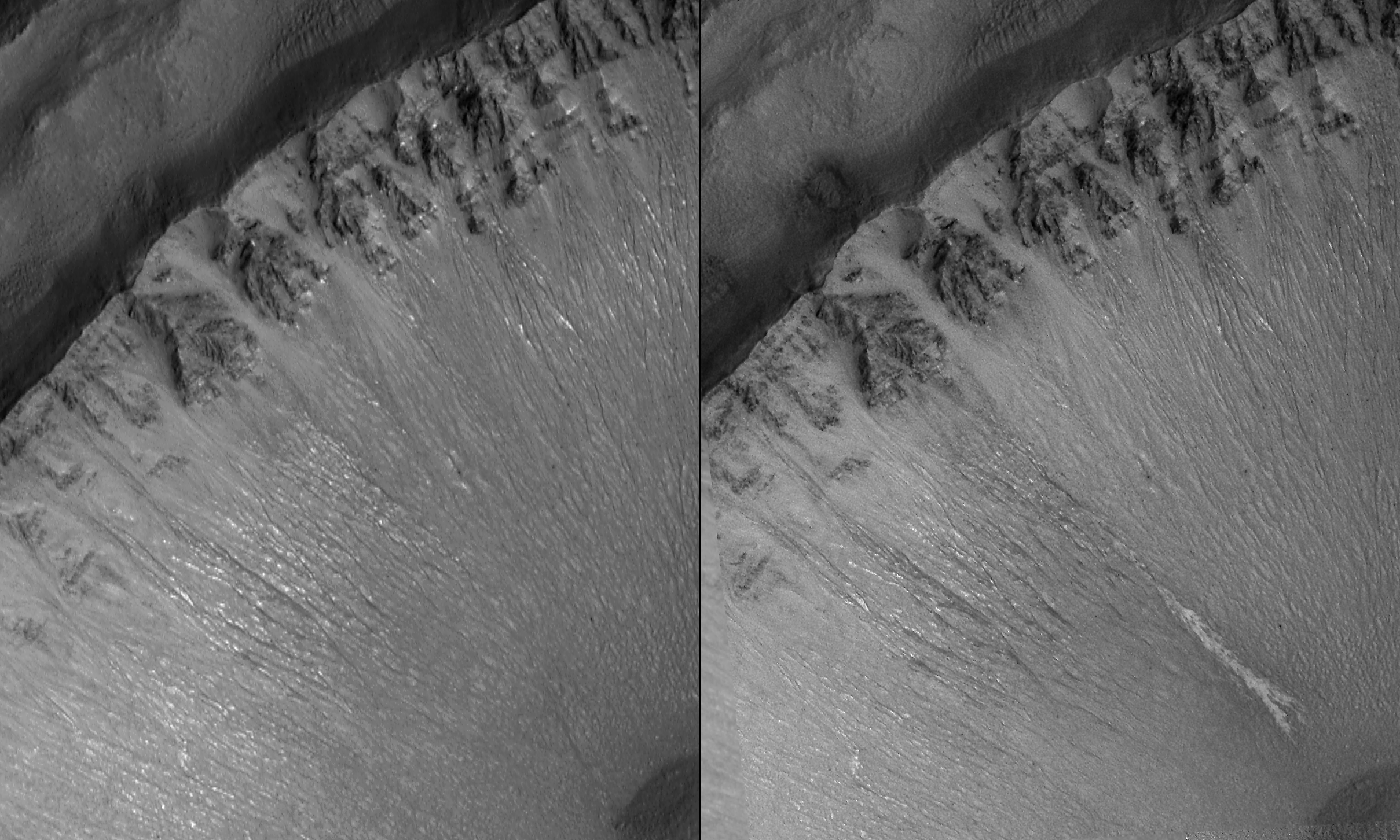
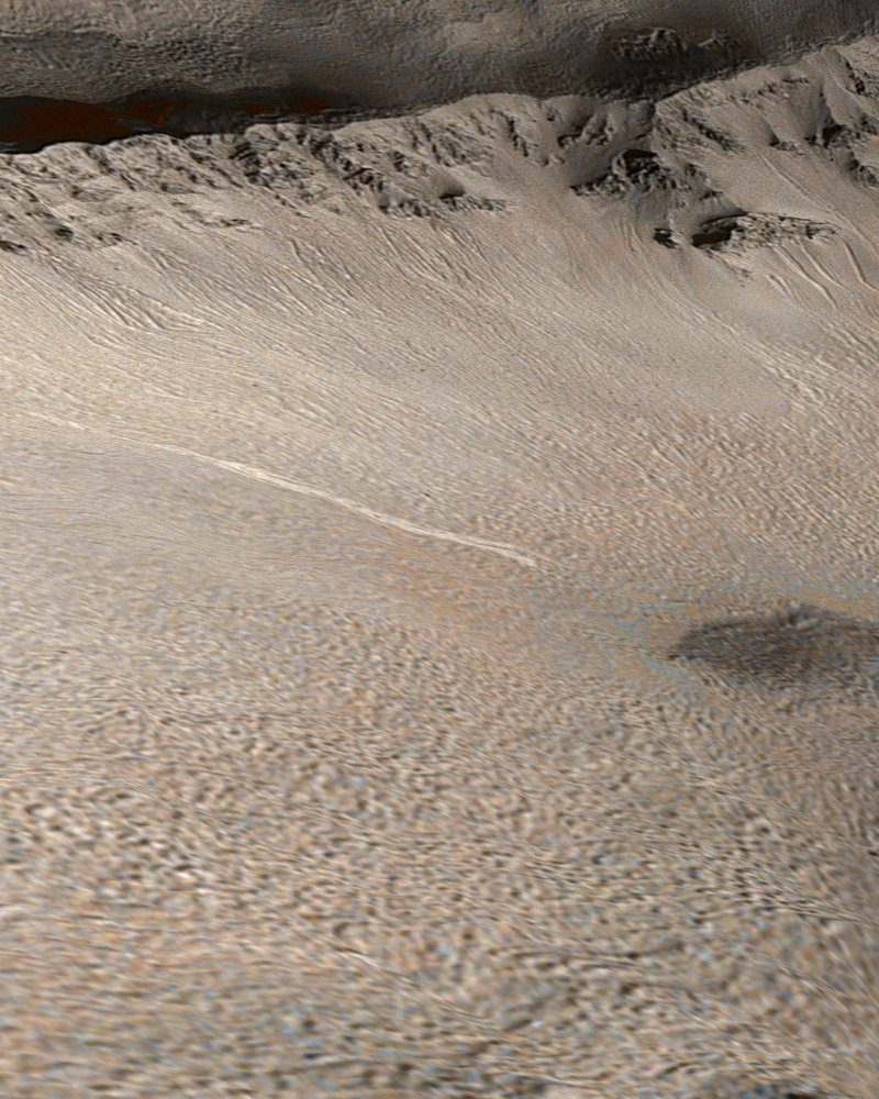
(A) The first figure (above, top) shows the southeast wall of the unnamed crater in the Centauri Montes region, as it appeared in August 1999, and later in September 2005. No light-toned deposit was present in August 1999, but we know from image R14-02285 that it had appeared by February 2004. The 300 meter scale bar also represents 328 yards.
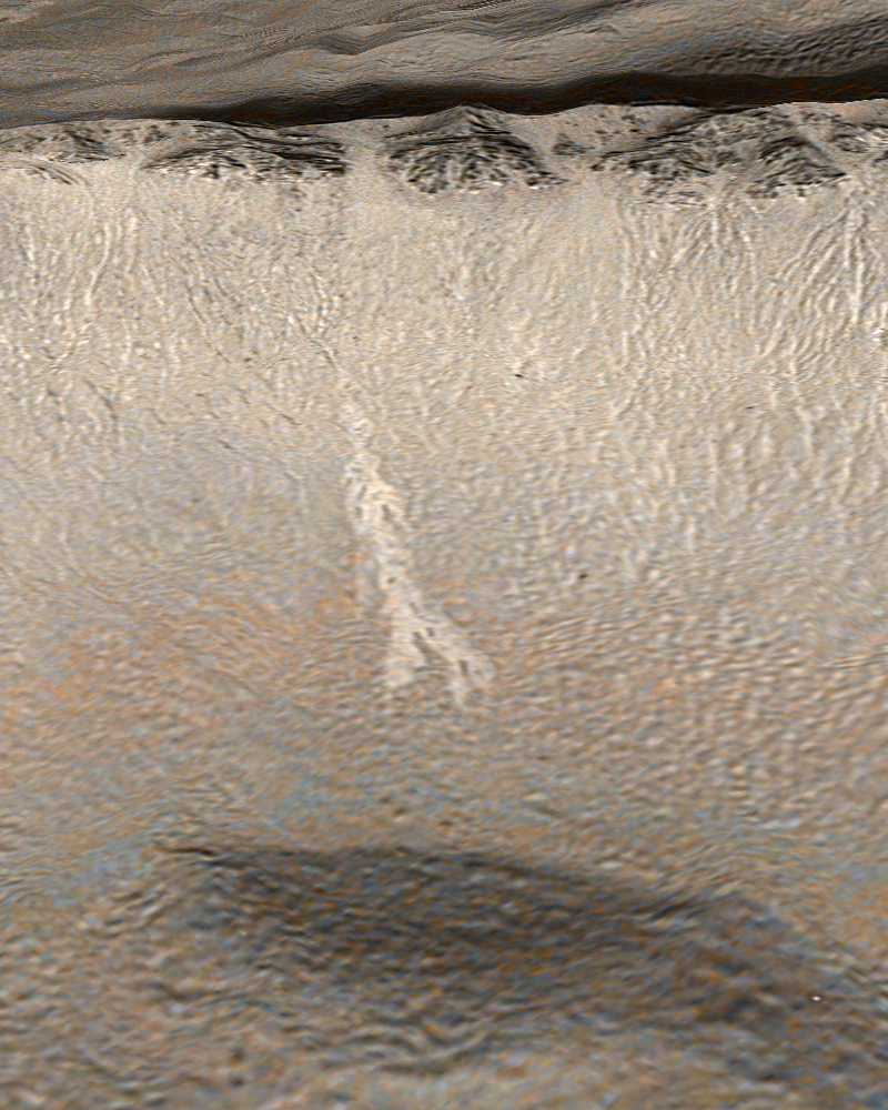
(B) The second figure (bottom, left) is a colorized view of the light-toned gully deposit, draped over a topographic image derived from MGS Mars Orbiter Laser Altimeter (MOLA) data. The color comes from a look-up table derived from the colors of Mars as seen by the Mars Reconnaissance Orbiter’s High Resolution Imaging Science Experiment (HiRISE).
(C) The third figure (bottom, center) is a mosaic of MOC images M04-04175, M20-00028, R14-02285, S10-00142, S11-00332, and S16-01250, colorized using a look-up table derived from Mars Reconnaissance Orbiter HiRISE color data and overlain on a sub-frame of Mars Odyssey Thermal Emission Imaging System (THEMIS) image V16997005. The 1 kilometer scale bar also represents about 0.62 miles.
(D) The fourth figure (bottom, left) is a colorized view of the light-toned gully deposit as viewed from an oblique perspective, draped over topography derived from MGS Mars Orbiter Laser Altimeter (MOLA) data. The color comes from a look-up table derived from the colors of Mars as seen by the Mars Reconnaissance Orbiter HiRISE camera.The new light-toned flow, by itself, does not prove that liquid water was involved in its genesis. However, this observation and the similar light-toned flow in Terra Sirenum together show that some gully sites are indeed changing today, and they provide tantalizing evidence that it may be possible that there are sources of liquid water—beneath the surface—on Mars right now. In both cases, these new flows may be indicating the locations of aquifers (sub-surface rocks saturated with water) that could be detected by orbiting, ground-penetrating radar systems such as the Mars Express Mars Advanced Radar for Subsurface and Ionosphere Sounding (MARSIS) or the Mars Reconnaissance Orbiter Mars Shallow Subsurface Radar (SHARAD).
Accompanying captioned releases regarding gullies on Mars:- New Gully Deposit in a Crater in Terra Sirenum:
Evidence That Water Flowed on Mars in This Decade?
- Other Martian Gullies With Light-Toned Deposits
- Why the New Gully Deposits Are Not Dry Dust Slope Streaks
- Support for Hypothesis that Groundwater is Source for Fluid Responsible
for Erosion in Martian Gullies
Malin Space Science Systems and the California Institute of Technology built the MOC using spare hardware from the Mars Observer mission. MSSS operates the camera from its facilities in San Diego, California. The Jet Propulsion Laboratory's Mars Surveyor Operations Project operates the Mars Global Surveyor spacecraft with its industrial partner, Lockheed Martin Astronautics, from facilities in Pasadena, California and Denver, Colorado.
 To MSSS Home Page
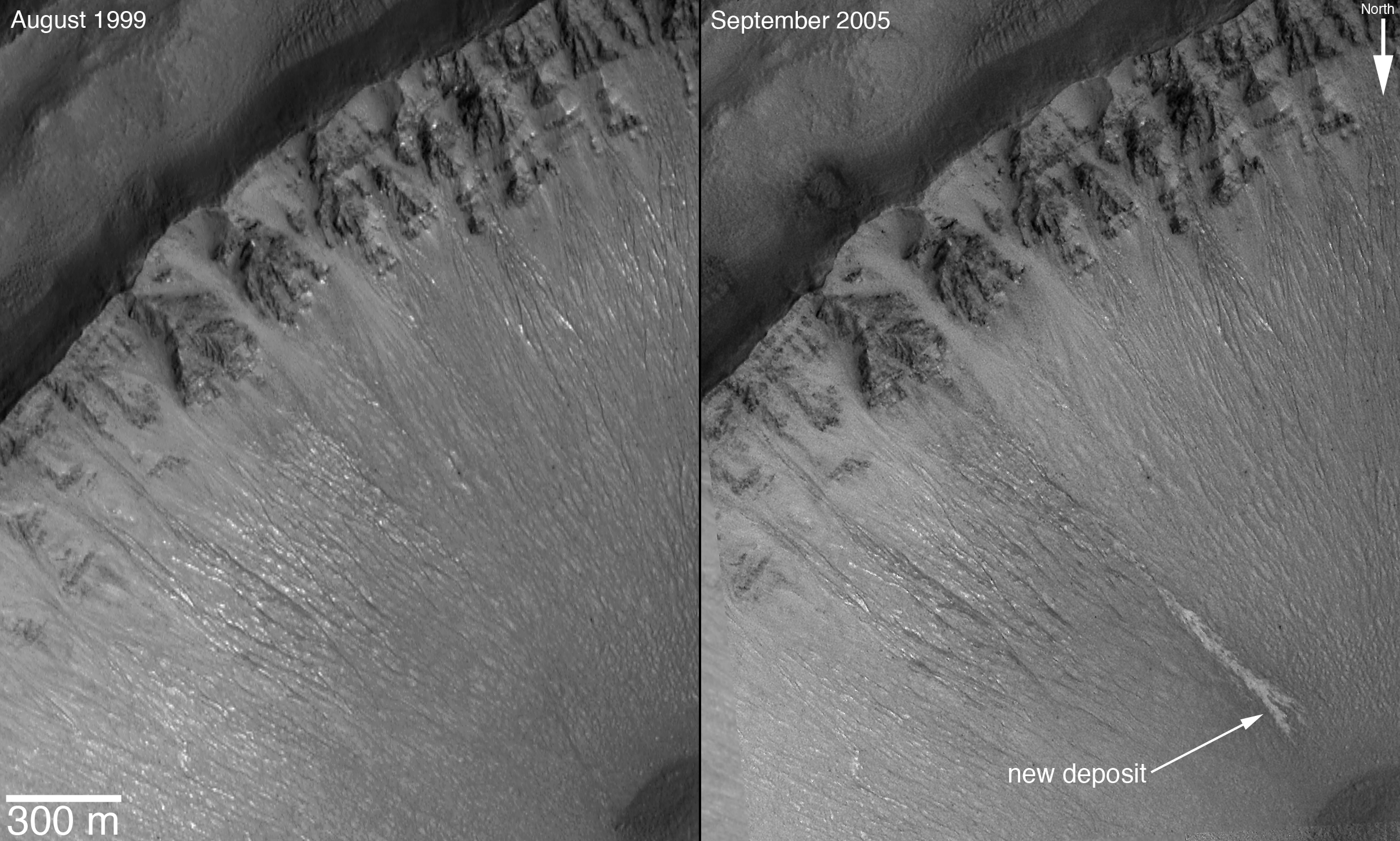