
Mars Global Surveyor
Mars Orbiter Camera
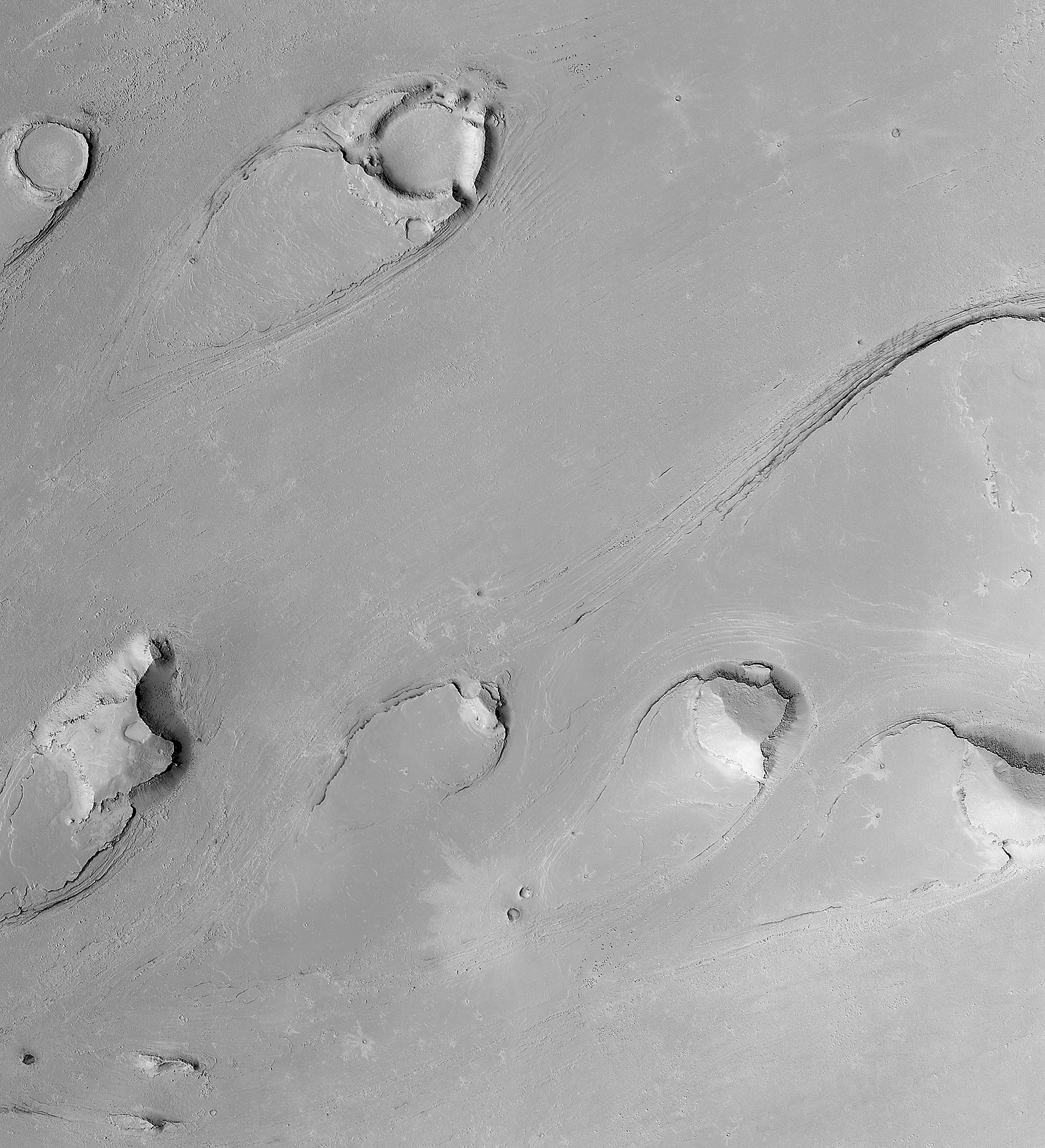
Athabasca Vallis Streamlined "Islands"
MGS MOC Release No. MOC2-322, 12 December 2002
Images Credit: NASA/JPL/MSSS
Caption by: K. S. Edgett and M. C. Malin, MSSS
Tremendous floods carved these tear drop-shaped landforms in
Athabasca Vallis in the Cerberus region, south of the Elysium volcanoes.
The orientation of the streamlined forms indicate that the fluid flowed
from the right/upper right toward the left/lower left (from the northeast
to the southwest). Similar features occur in central and eastern Washington
in the northwestern United States. The examples in Washington formed when
massive amounts of water rushed across the landscape, scouring a
"channeled scabland" during the last Ice Age, roughly 12,000-13,000 years
ago. The features on Mars are much older; while the absolute age cannot
be determined, the small impact craters with rayed ejecta patterns on the
flood surfaces indicate it must be much, much older than the flood landscape
in Washington. This is a mosaic of six Mars Global Surveyor (MGS)
Mars Orbiter Camera (MOC) images acquired in 1999 through 2002.
Illumination is from the left. The mosaic covers an area 11.9 km (7.4 mi)
by 13.0 km (8.1 mi). The
full-size
mosaic has a resolution of 4 meters (13 ft) per pixel.
Images Credit: NASA/JPL/Malin Space Science Systems
Caption by: K. S. Edgett and M. C. Malin, MSSS
Malin Space Science Systems and the California Institute of
Technology built the MOC using spare hardware from the Mars Observer
mission. MSSS operates the camera from its facilities in San Diego,
CA. The Jet Propulsion Laboratory's Mars Surveyor Operations Project
operates the Mars Global Surveyor spacecraft with its industrial
partner, Lockheed Martin Astronautics, from facilities in Pasadena, CA
and Denver, CO.
 To MSSS Home Page
