
MGS MOC Release No. MOC2-299, 1 February 2002
|
Although digital products such as the Mars Digital Image Mosaic (MDIM) and various Mars Global Surveyor (MGS) Mars Orbiter Laser Altimeter (MOLA) maps have partially supplanted the ATLAS, it remains a standard desktop reference today.
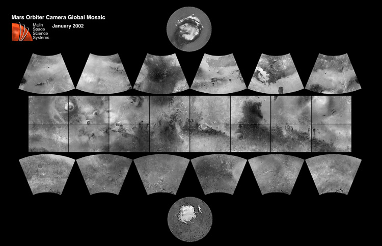
In 1999, the Mars Orbiter Camera (MOC) aboard the MGS orbiter acquired a global stereo image dataset using its red-filter Wide Angle Camera. We have recently completed a 256 pixel/degree (about 230 meters/pixel) mosaic of these images using software developed at Malin Space Science Systems (MSSS). To access both partial and full-resolution mosaics in Planetary Data System format, CLICK HERE.
The image above is a reproduction of the new MGS MOC Mars Digital Map. By clicking on the various sections (quadrangles) of the map, one can access the atlas at two resolutions: first a browse image at about 6 km/pixel, and by clicking on that browse image, at a resolution of about 1 kilometer per pixel (~0.62 miles per pixel). Each quadrangle is independently contrast-enhanced and labeled with a 5-degree grid. This is the first of several cartographic products that MSSS expects to release this year.
The index map can be viewed at full resolution by clicking here.
Malin Space Science Systems and the California Institute of Technology built the MOC using spare hardware from the Mars Observer mission. MSSS operates the camera from its facilities in San Diego, CA. The Jet Propulsion Laboratory's Mars Surveyor Operations Project operates the Mars Global Surveyor spacecraft with its industrial partner, Lockheed Martin Astronautics, from facilities in Pasadena, CA and Denver, CO.
 To MSSS Home Page
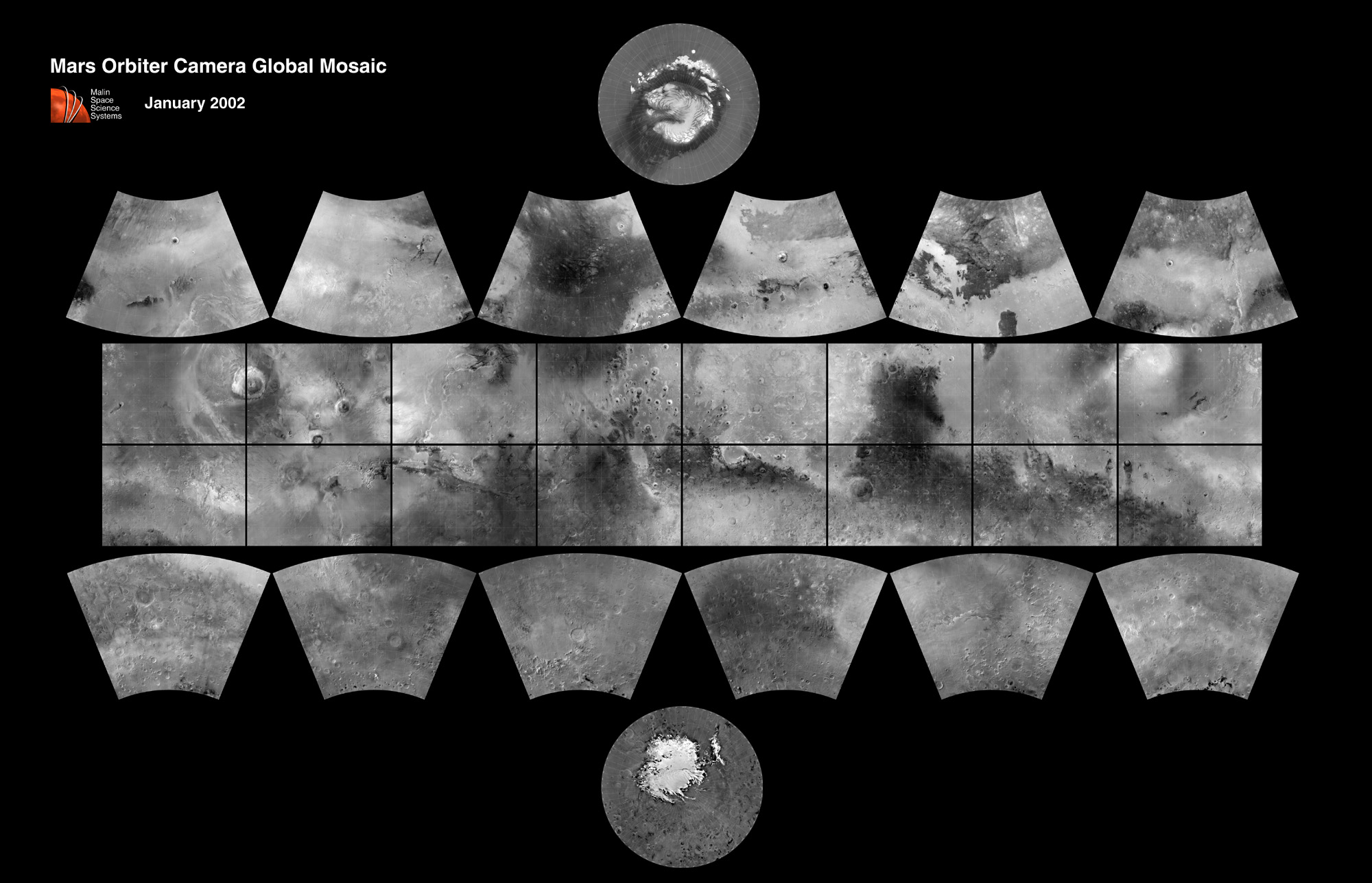